(Click to see a larger image in a new tab.)
QGIS
QGIS: Drawing in QGIS
Draw building outline shapes using Google Street Map as a base
QGIS: Collecting Data from Online
Retrieve spatial data from data.gov.sg
QGIS: Collecting Data in QGIS
Download GIS data from OpenStreetMap
QGIS: Site Trimming
Select the relevant features for a specific site from an island-wide range of data
QGIS: Exporting as DXF
Export vector layers in QGIS as DXF files
Houdini
Houdini: Importing GIS Files
Learn how to import SHP and DXF files into Houdini
Houdini: Creating Parcels and Plots
Create parcels and plots from an imported line drawing
Houdini: Exporting 3D Models (OBJ, SHP)
Export 3D models in Houdini to OBJ and SHP file formats
QGIS
QGIS: From Houdini to QGIS
Learn how to add SHP files exported from Houdini as vector layers in QGIS
QGIS: Preparing the Urban Area
Downsize the urban area for a more focused approach
–
Distance Calculations
QGIS: Distance Calculations
Learn how to determine the distance between a plot and a road
QGIS: Distance Calculations II
Learn how to determine the relationship between a plot’s relative position between two roads
QGIS: Distance Calculations III
Learn how to create other attributes (e.g. plot ratio, coverage, etc.) for plots in an urban area based on distance to roads
–
Raster Data
QGIS: Creating Attributes with Image Maps
Create attributes (e.g. number of floors) using a user-generated black-and-white image
QGIS: Creating Attributes with Heatmaps
Learn how to use raster data (e.g. heatmaps) to create attributes in QGIS
Houdini
Houdini: Creating Building Typologies (Stock)
Create building typologies with the Urban Type 1 node
QGIS
QGIS: Creating a Heatmap
Create a heatmap, e.g., indicating the proximity to bus stops
QGIS: Buffer Analysis
Learn how to calculate the number of people living within 100m of a bus stop
QGIS: Figure Ground
Create a figure ground map of an urban area
QGIS: Distance to Nearest Hub
Create a visual representation of the nearest bus stop to each building in an urban area
Example
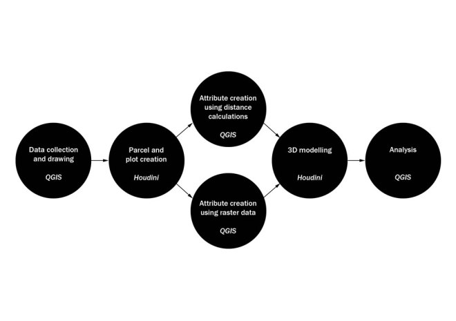
Houdini: Parcel and Plot Creation
QGIS: Attribute Creation Using Distance Calculations
Houdini: 3D Modelling
QGIS: Analysis
