The Jurong Industrial Estate (JIE) GIS dataset requires a custom coordinate reference system (CRS) for its location in Singapore.
In this tutorial, we will learn how to create a user-defined CRS in QGIS.
Go to QGIS: Coordinate Reference Systems (CRS) to learn more about CRS and its applications.
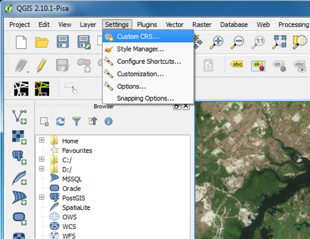
Go to Settings > Custom CRS.
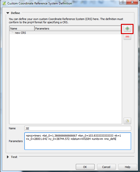
Click the + button and type JIE as the CRS name.
Under its Parameters, input the following:
+proj=tmerc +lat_0=1.366666666666667 +lon_0=103.8333333333333 +k=1 +x_0=28001.642 +y_0=38744.572 +datum=WGS84 +units=m +no_defs
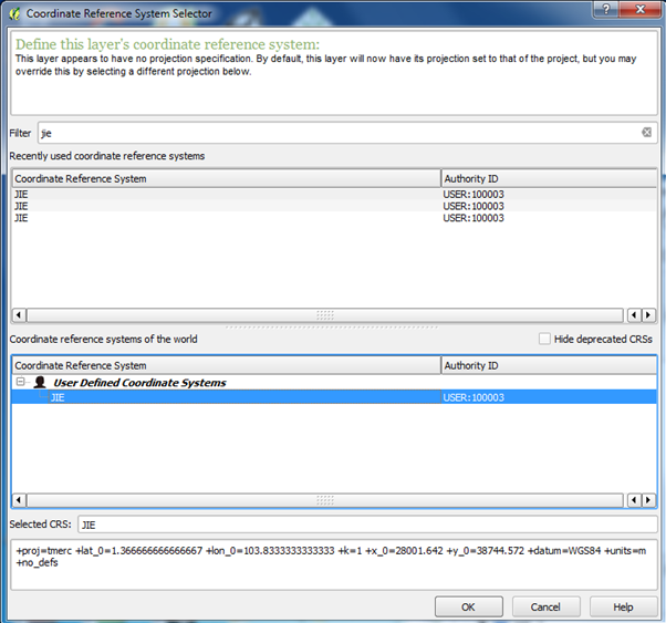
In QGIS, after importing the vector layer, right-click the layer name and Set Layer CRS.
Select this CRS from the list, under User Defined Coordinate Systems.